Hybrid Systems Lab · Fachbereich Gestaltung · FHV Vorarlberg · Dornbirn
Hybrid Systems Lab
Karten, Archive, Werkzeuge – was auf hybridsystems.at stehtMaps, archives, tools – what lives on hybridsystems.at
(01)Kurskarten · Geo-Archiv · FaltkarteCourse maps · Geo-archive · Fold-out
Karten
maps.hybridsystems.at
Eine Karte pro Kurs. Studierende sammeln zu Fuß – Fotos, Töne, Notizen, Marker – und jeder Fund wird ein Eintrag im Geo-Archiv: mit Ort, Zeit, Nummer und der Person, die ihn gesammelt hat. Unter den Funden liegen Höhenlinien, der Seeboden und die Schichten aus VOGIS.One map per course. Students collect on foot – photos, sounds, notes, markers – and every find becomes an entry in the geo-archive: with place, time, number and the person who collected it. Under the finds lie contour lines, the lake bed and the VOGIS layers.
Jeder Marker öffnet sich als Archivkarte, faltet sich zu einer kleinen Website auf (Karte · Info · Labor) und lässt sich als Faltkarte drucken: A4 bis A1, Vektor, mit QR-Code zurück zum Eintrag.Every marker opens as an archive card, unfolds into a small website (map · info · lab) and prints as a fold-out map: A4 to A1, vector, with a QR code back to the entry.
- Kurskarte EcodesignlabCourse map Ecodesignlab/ecodesignlab
- Kurskarte Design Challenge 26/27Course map Design Challenge 26/27/DCL
- Alle Kohorten · Psychogeografie Dornbirn 2026All cohorts · Psychogeografie Dornbirn 2026/3d
- Faltkarte drucken · A4 · A3 · A2 · A1Print the fold-out · A4 · A3 · A2 · A1/api/print/<marker>
- Hub · Projektdokumente · internHub · project documents · internal/hub/
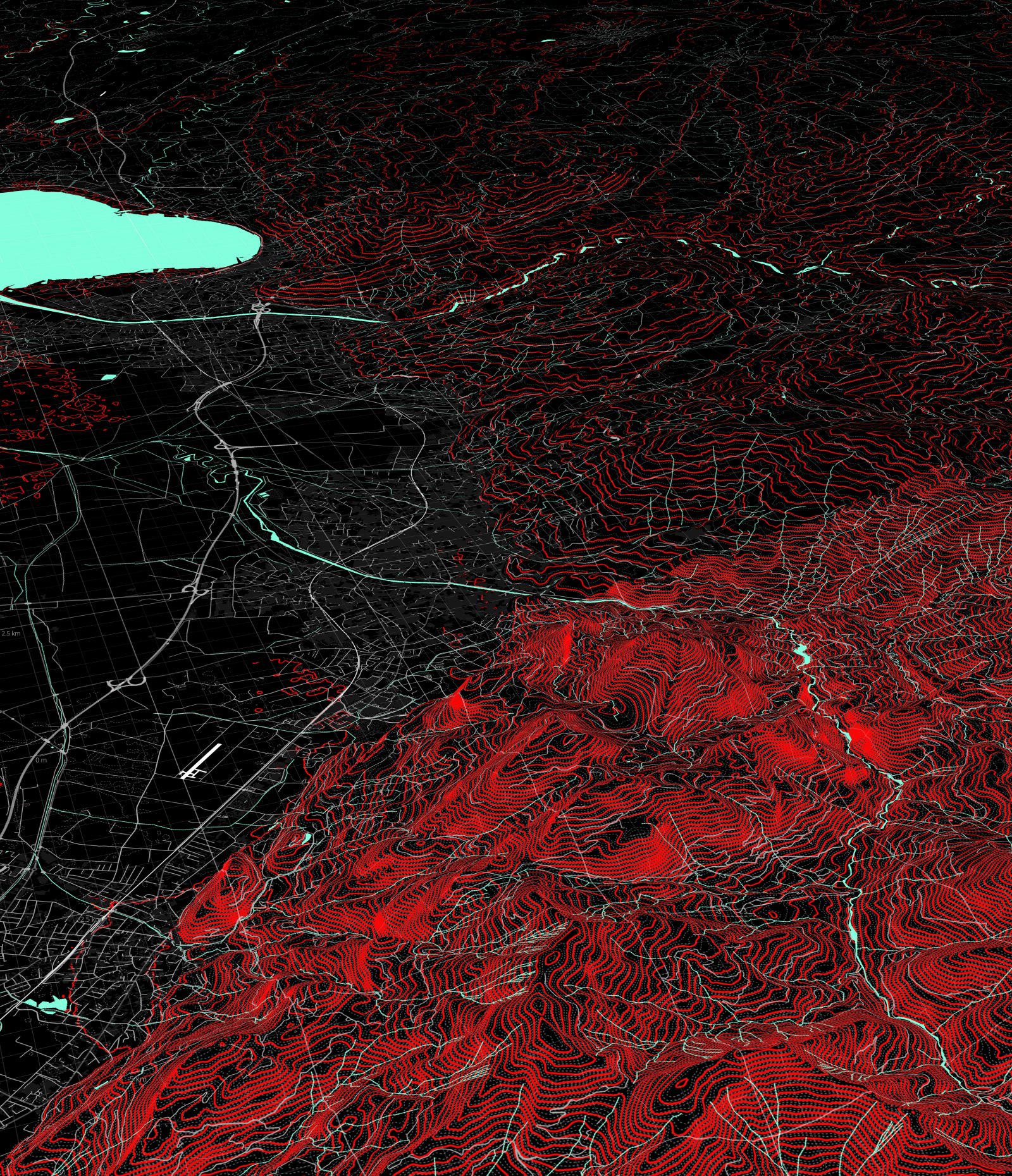
Geo-Archiv Dornbirn
Kursseite /ecodesignlab — 2026Course page /ecodesignlab — 2026 (01)
- Raster
- 2,5 m
- SchichtenLayers
- VOGIS · OSM · FeldField
- Ort
- N→ 47.4049 · E→ 9.7452
(02)Foto · Ton · Notiz · Marker
Begleitinstrument
app.hybridsystems.at
Die Handy-Web-App zum Sammeln. Anmelden mit Name und Kurs, dann vier Tasten: Foto, Ton, Notiz, Marker. Jeder Fund wird sofort am Gerät gesichert und von selbst gesendet; der Bildschirm sagt immer, was gespeichert, unterwegs oder online ist. Die Spur (GPS) ist ein Schalter, kein Pflichtprogramm.The phone web app for collecting. Sign in with name and course, then four keys: photo, sound, note, marker. Every find is kept on the device first and sent by itself; the screen always says what is saved, travelling or online. The GPS trail is a switch, not a requirement.
Eigene Marker lassen sich später ergänzen – Mikroskop, Makro, Gaussian Splat, Links – und erscheinen sofort auf der Kurskarte. Tonaufnahmen werden mit BirdNET auf Vogelstimmen geschätzt, mit Konfidenz und Schwelle.Own markers can be extended later – microscope, macro, Gaussian splat, links – and appear on the course map at once. Sound recordings are estimated for bird species with BirdNET, with confidence and threshold.
- App · Ecodesignlab · DCLApp · Ecodesignlab · DCLapp.hybridsystems.at
- Vorschau der nächsten Version · internPreview of the next version · internal/next/
Beruht auf einem Werkzeug und einer Praxis, die Andrijana Brkovic MA im Rahmen ihrer Masterarbeit entwickelt hat.Based on a tool and practice developed by Andrijana Brkovic MA in the course of her master thesis.
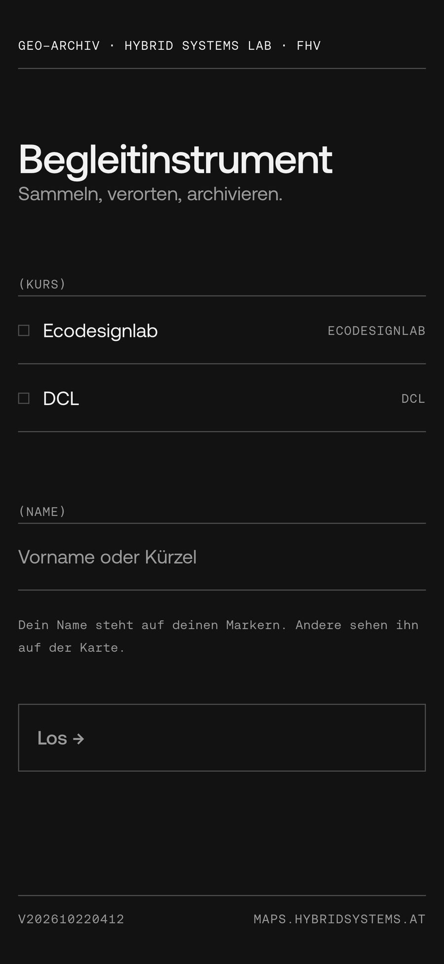

App und ArchivkarteApp and archive card
2026 (02)
- EinheitUnit
- Marker
- Spur
- optionaloptional
- Ton
- BirdNET 2.4
(03)VOGIS · Bodensee · MapTiler · Unreal · interninternal
Editor & geobridge
geobridge.hybridsystems.at
Das Autorenwerkzeug der Kurskarten: ein Stil pro Karte, Schichten aus dem VOGIS- und Bodensee-Katalog (68 Datensätze), Masken, der Seeboden ins Gelände gerechnet, SVG-Export für den Druck. Der Editor fügt den Karten Daten hinzu; die Grundkarte selbst liegt in MapTiler.The authoring tool of the course maps: one style per map, layers from the VOGIS and Bodensee catalogue (68 datasets), masks, the lake bed merged into the terrain, SVG export for print. The editor adds data to the maps; the basemap itself lives in MapTiler.
Dahinter geobridge: ein Python-Paket, das öffentliche Geodaten – VOGIS WFS/WCS, BEV-Lidar, OSM, PEGELONLINE, swisstopo – in saubere GeoJSON-, PMTiles- und Geländekacheln übersetzt, für die Karten und für das Seeprojekt in Unreal.Behind it, geobridge: a Python package that turns public geodata – VOGIS WFS/WCS, BEV lidar, OSM, PEGELONLINE, swisstopo – into clean GeoJSON, PMTiles and terrain tiles, for the maps and for the lake project in Unreal.
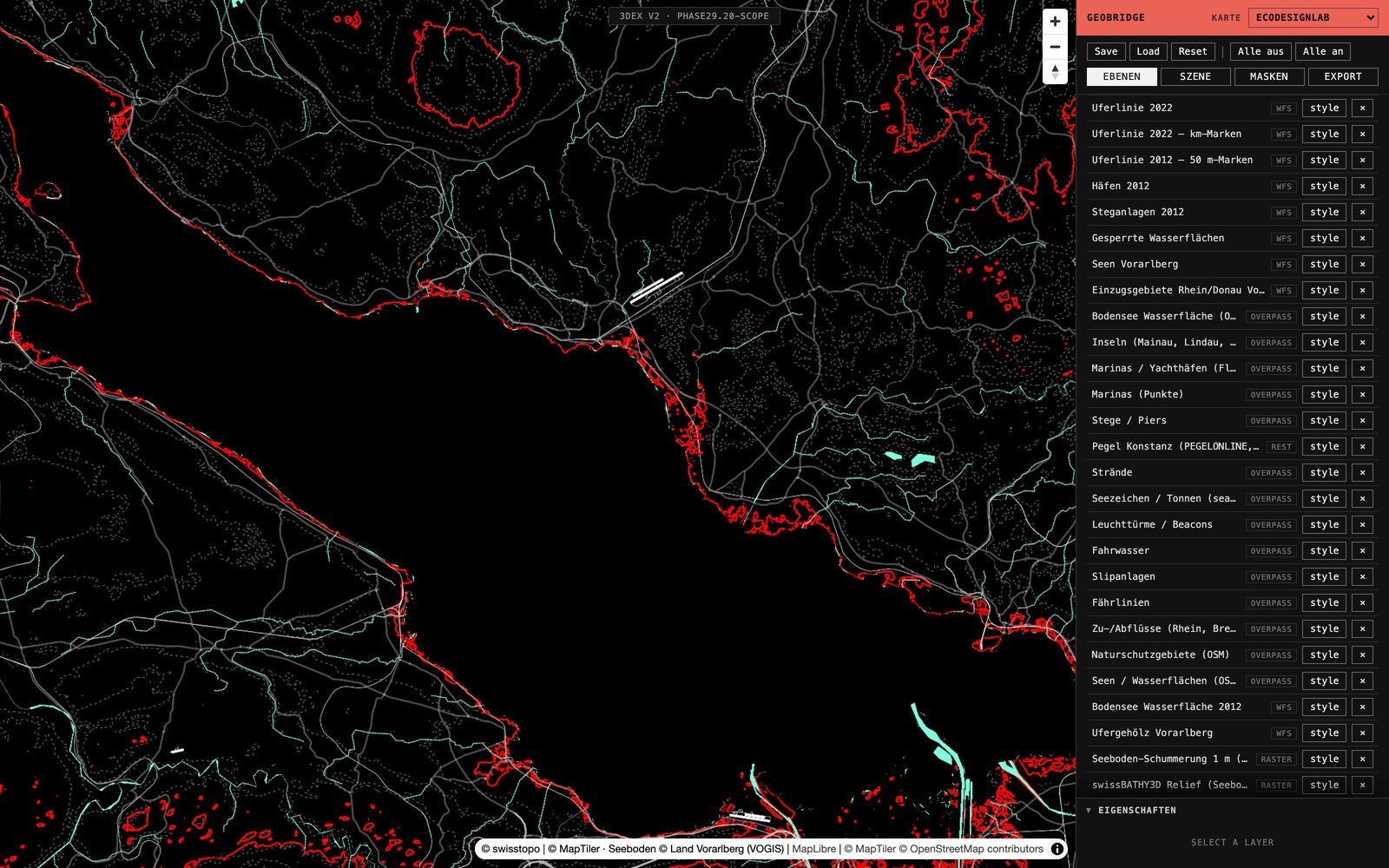
Editor · EbenenLayers
2026 (03)
- KatalogCatalogue
- 68 Datensätzedatasets
- CRS
- EPSG:25832
- GeländeTerrain
- VOGIS · Seeboden
(04)Map · Grid · Folder · Digital / Print
Designsprache
design.hybridsystems.at
Die Gestaltungssprache des Fachbereichs: Karte, Raster, Falz. Sechs Kapitel, ein Manifest mit zwölf Sätzen, Vorlagen für Plakat, Programm und Faltkarte – und die Texte des Labs, zweisprachig.The department's design language: map, grid, fold. Six chapters, a manifesto in twelve sentences, templates for poster, programme and fold-out – and the lab's texts, in two languages.
- Designsprache · Kapitel 01–06Design language · chapters 01–06/
- Manifest · zwölf Sätzetwelve sentences/#manifest
- Text · Das schätzende BildText · The Estimating Image/estimating-image.html
- Art Papers · Doubleblind · Lab & Toolbox/art-papers.html
- Vorlagen · ZIPTemplates · ZIP/templates/Hybride-Systeme-Templates.zip
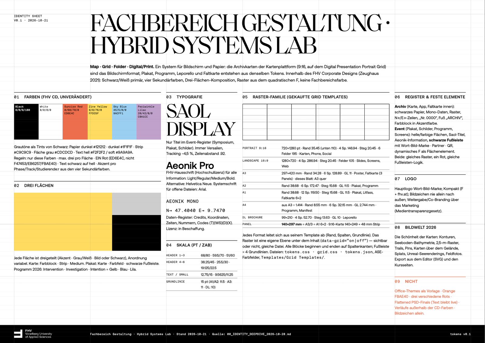
IdentitätsblattIdentity sheet
2026 (04)
- SchriftType
- Saol · Aeonik · Mono
- AkzentAccent
- #ED6E4C
- Raster
- 12 · 8 · 4
(05)Labor · Aufgaben · Protokoll · internLab · tasks · log · internal
Dashboard
dashboard.hybridsystems.at
Das Arbeitsbrett des Labs: Aufgaben, Protokoll und Dokumente der laufenden Projekte – Kurskarten, Seeprojekt, Symposium. Es läuft auf dem Labor-PC und ist über einen Tunnel erreichbar, mit Login.The lab's working board: tasks, log and documents of the running projects – course maps, lake project, symposium. It runs on the lab PC and is reached through a tunnel, with login.
Die Karte ist das Argument.
(wir bauen Karten)The map is the argument.
(we build maps)
 hybridsystems.at